When I left St.Louis in 95, I had a brand new road atlas on the passengers seat of my trusty Ford. Beginning with that road trip to Montana, I started tracing all roads I travelled on the two-page map found in the front of the book. In the years that followed, the northwest corner of the map became riddled with my etchings. I began to take alternative routes during road trips for the sole purpose of being able to trace new highways, even if it added hours (or even days) to my trip.
I'm not sure that Cate and Lela will share the same obsession for exploring, but if they do I hope they'll be happy that they got off to such a good start...
Owl Loop, Boise Foothills
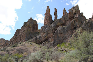
Wilson Creek, Owyhees
 |
| First 4-Wheelin |
 |
| Rain in Owyhees = Plan B: Return to Paved Road ASAP |
 |
| Lela didn't like Plan B |
 |
| Plan B Hike |
Chickadee Ridge, Boise Foothills
 |
| With Friends HP and Sofia |
Leslie Gulch via Succor Creek, Oregon
 |
| Along Succor Creek |
 |
| With Friends Mike and Amelie |
 |
| The girls learned all about trail bribery from Amelie |
Cate and Lela were worried that you might not believe they've really been on all these grand adventures. They said something about it looking like we were just carrying a sack of potatoes in those carriers. It's true that potatoes are easy to come by in these parts so I guess I understand their concern.
We debated long and hard over whether or not to release the photo evidence of their presence, but in the end we decided that the photos were not too gruesome nor did they pose a substantial security risk. They may however raise questions about whether they're receiving proper parental care. You decide...


No comments:
Post a Comment